ACCESSIBILITY CATCHMENTS
As a Transport Planning Consultant, I understand the critical importance of demonstrating accessibility in development planning. Accessibility can significantly influence planning decisions, often determining the success or refusal of an application. I am dedicated to providing cutting-edge solutions for walking and cycling catchments / isochrones, ensuring your projects have the best chance of approval.
Why Accessibility Catchments Matter
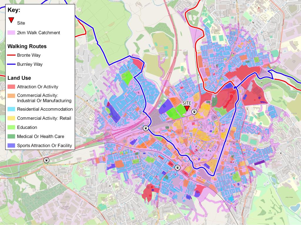
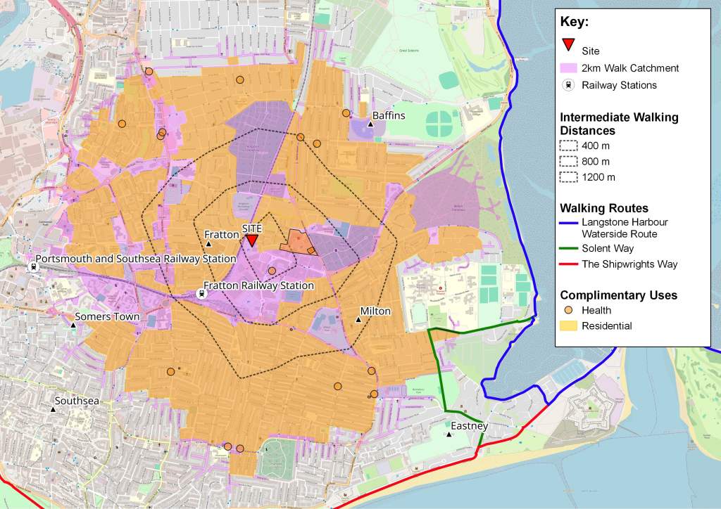
Accessibility catchments are essential tools in demonstrating the reachability of a site within specific timeframes or distances by walking or cycling. These catchments provide a clear understanding of the areas accessible from your development, highlighting the site’s connectivity and potential appeal to future users. Accurate catchment analysis is vital for:
- Planning Approvals: Ensuring compliance with planning regulations that increasingly prioritise alternative transport modes.
- Stakeholder Engagement: Presenting clear, compelling evidence of accessibility to stakeholders and decision-makers.
- Sustainable Development: Promoting sustainable transport options and reducing reliance on cars.
Advantages of A Bespoke GIS Solution
Many developers have relied on off-the-shelf tools like OpenRouteService (ORS) or Travel Time for catchment analysis, but these solutions often overestimate distances, leading to potential planning setbacks. My bespoke GIS solutions offer a more accurate and feature-rich approach utilising industry leading Google Maps API to ensure your catchment data is precise and reliable.
Key features of the bespoke GIS support include:
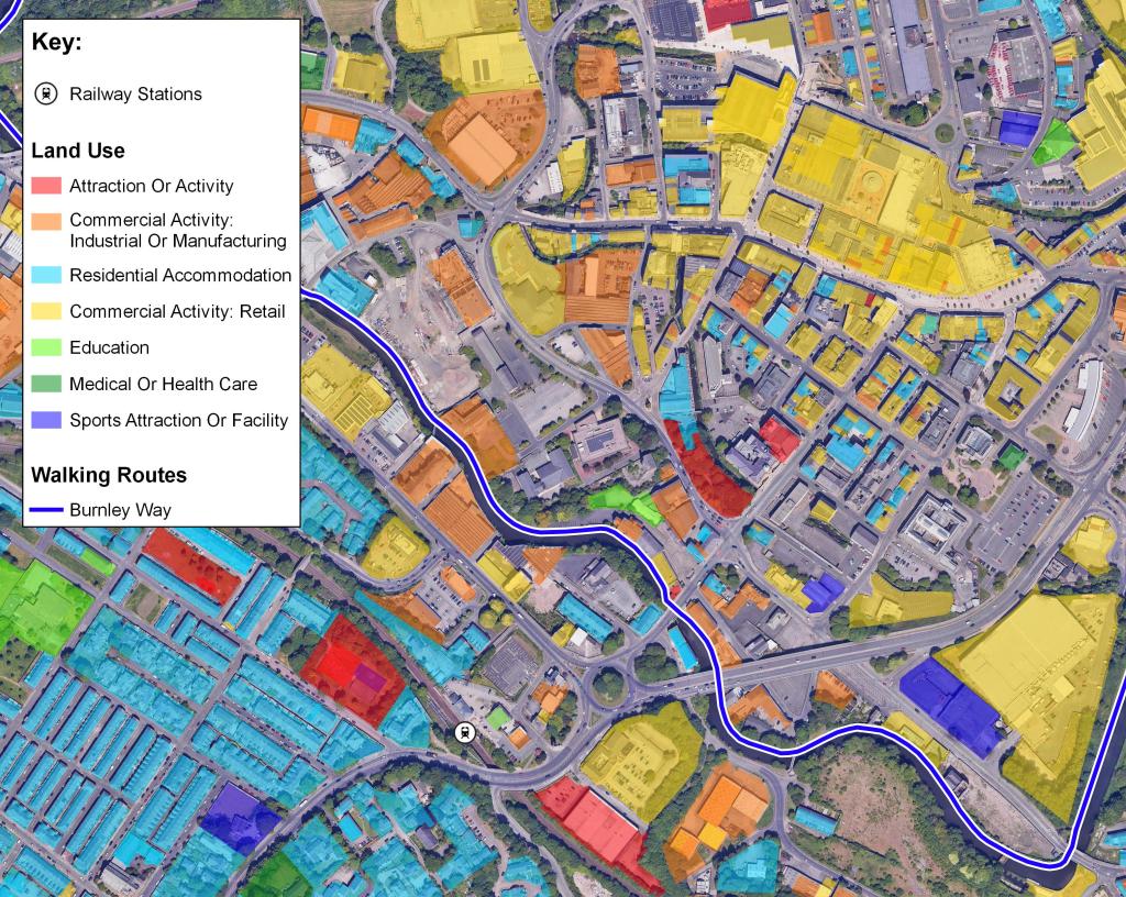
- Detailed Mapping: High-quality, visually captivating maps that clearly illustrate accessibility.
- Accurate Analysis: Precise catchment estimations that reflect real-world conditions.
- Comprehensive Insights: Identification of amenities and land uses within catchment areas, providing a holistic view.
- Enhanced Engagement: Clear, accurate visual representations that effectively communicate accessibility to stakeholders.
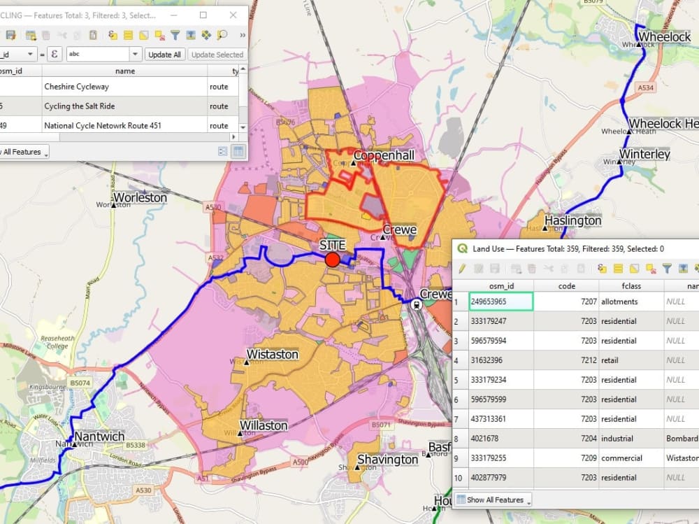
Unmatched Precision with OS NGD Datasets
I am thrilled to announce the integration of the OS NGD Datasets from Ordnance Survey into the mapping system. This update brings an unprecedented level of detail and accuracy to land use data, offering granular insights into local amenities. Ordnance Survey is a recognised authority, ensuring the reliability of land use data. With this addition, my system sets a new industry standard in walking and cycling catchment analysis.
Transforming Your Projects with Accurate Data
In development planning, accuracy is non-negotiable. My bespoke GIS methodology ensures that you receive the most precise catchment analysis available. By leveraging the power of detailed geographic data, I help you make informed decisions that drive successful projects.
My services are designed to support your development from feasibility studies through to planning applications, offering continuous improvement and innovation. Discover the difference my Accessibility Catchments can make for your development projects. Contact me today to learn more about how the bespoke GIS solutions can support your planning needs and elevate your projects to new heights.
